Atul Nayak
Research
Wiggleview
Wiggleview is a 3D visualization of seismic data. Data collected at a
network of stations is displayed as seismograms, particle motion and seismoglyphs.
More details here.
Some literature survey here.
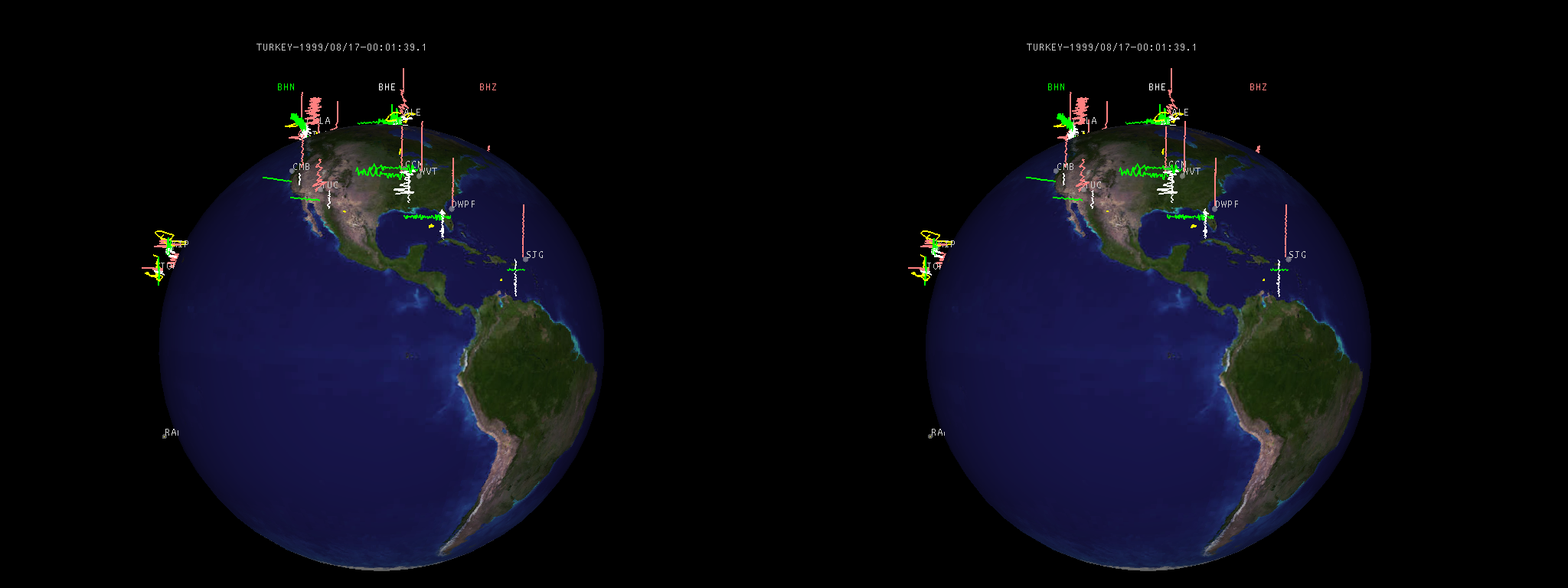 |
| Fig 1.1: Stereo image of data collected for the Turkey earthquake over the IRIS network. Click on the image for larger image. |
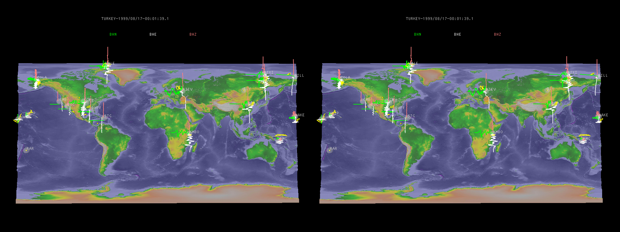 |
| Fig 1.2: A different view of the same data. Click on the image for larger image. |
Immersaview is a Open Inventor/ VRML model viewer for the Geowall.
More details at the Immersaview
website.
|
| Fig 2.1: Stereo image of hypocenters data visualized with Immersaview. |
The goal of the Continuum Project is to develop integrated ubiquitous
tools and environments to enhance collaboration amongst distantly located
knowledge workers, such as scientists and engineers.
CAVERNsoft
QUANTA
Parallel TCP experiments
Geowall
Documentation for Access Grid
IGrid Geowall Demo Description