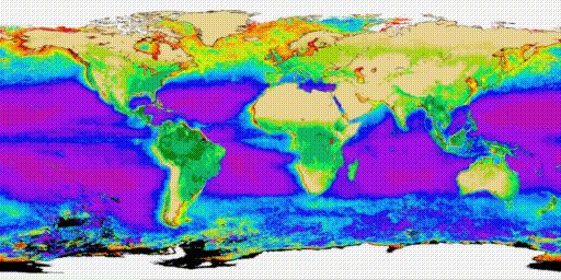
The Biosphere image shows the distribution of vegetation on the land
and phytoplankton in the oceans. It is a composite of several years
worth of satellite data from the AVHRR instrument (for land) and
the CZCS instrument (for the oceans).
Last modified 21 June 1995.
Dave Pape, pape@evl.uic.edu