
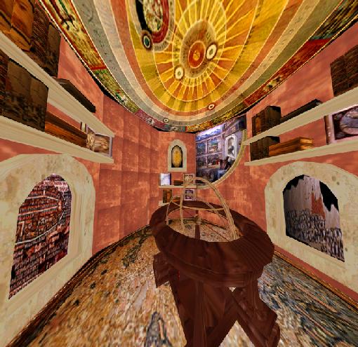
- the GEOGRAPHY room -
One of the curiosity or study rooms found in the labyrinth is the geography room,
which comes to display the lure and fascination of an antique very popular in the middle
ages. Medieval mapmaking stresses beauty over accuracy. We know that the globular form
of the earth was recognized by most scholars and geographers of the Middle Ages,
but medieval mapmakers were rooted in the dogmas of the Christian church and
scientific precision was not a primary concern. While many of these maps were very
elaborate and often highly decorative, the geographical knowledge was crude,
inaccurate and oddly organized.
The science and art of geography is intrinsically relevant to the metaphors of labyrinth and library in the hiden or explicit games of taxonomy, structure, list-making, categorization, grids, numbers, and scholarship exhibited. In this sense, this room of the labyrinth is conceptually and aesthetically influenced by the writings of Jorge Luis Borges (especially his description of the Library of Babel and the Garden of Forking Paths), Prospero's books, and ultimately Peter Greenaway's style of filmmaking. Many analogies can be made between elements in these works and the theme of the labyrinth as well.
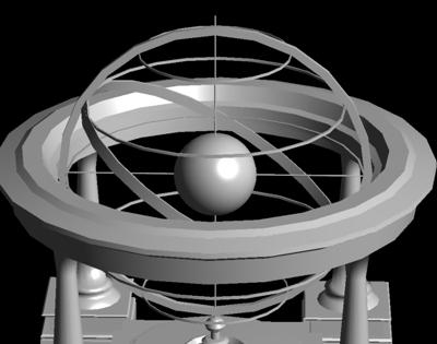
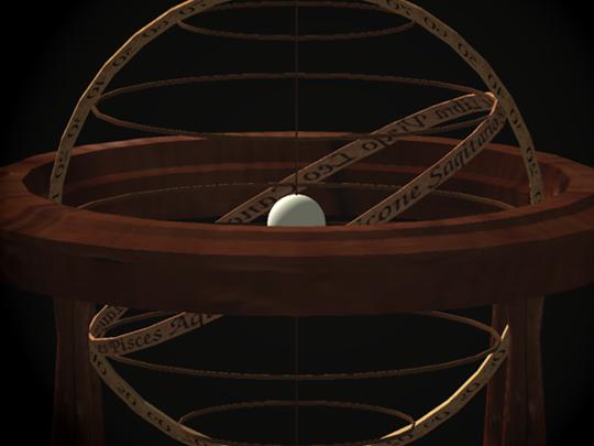
The center of the octagonal geography room is dominated by a unique terrestrial globe model which represents the fundamentals of Ptolemy's geographical system. Claudius Ptolemy exerted great influence on later generations of mapmakers and explorers. His concept of measuring the world through longitude and lattitude is still used by modern geographers. Unlike other globes, this terrestial globe does not emphasize the earth but instead the tools used to measure and classify the earth. It includes a small solid sphere in the middle to represent the earth while surrounding it are wide bands, like ribbons, that represent the longitude and lattitude, the horoscope signs, and the tropics of cancer and capricorn.
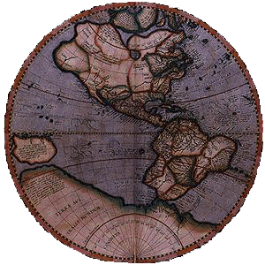
The sphere in the centerpiece as well as on the floor is mapped with the earliest example of a mappamundi or "cloth of the world": a map of the whole world finished in 1459 in Murano, Venice by Fra Mauro. Fra Mauro was a catholic monk who made the largest extant late medieval or early world map in his cell, without ever leaving Venice. The map measured 1,960 x 1,930 mm. and is inverted -the south is drawn at the top.
The ceiling displays the Planisphaerium sive universi totius, a celestial chart illustrating the sun-centred system outlined by Copernicus. Copernicus is popularly remembered as the astronomer who laid the foundations of our modern view of the universe.
Around this globe centerpiece, scattered books lay open, each one revealing a part of the world (in the sense of space or time) through their contents. Several images of maps for the books that represent the geography of the world were chosen. The choice of these particular images is based on their importance to geography, aesthetic value, uniqueness, or rareness. These include:
While inside the geography room, a female voice can be heard reciting the list of all known places in the world taken from Ptolemy's Geography. Additionally, a very beautiful excerpt from Gotterdamerung, the fourth opera in Wagner's "Ring", is heard.
sources: 8, 9, 10