
3D City Reconstruction From Google Street View
January 1st, 2016
Categories: Applications, VR, Video Games, Augmented Reality
About
Google Street View can be considered as an online browsable dataset consisting of billions of street-level panoramic images acquired all around the world. Since 2007, the company has continuously improved and updated its global image database, now collecting on average one panorama each 5-10m in urban environments. Google provides public APIs for requesting virtual camera views of a given panorama from its GPS position or unique identifier. These views are rectilinear projection of the spherical panorama with a user selected field of view, orientation and elevation angle. These views can be considered as undistorted images taken from pinhole cameras, free of distortion, and need to be partially overlapped in order to reconstruct the 360 degree panorama.
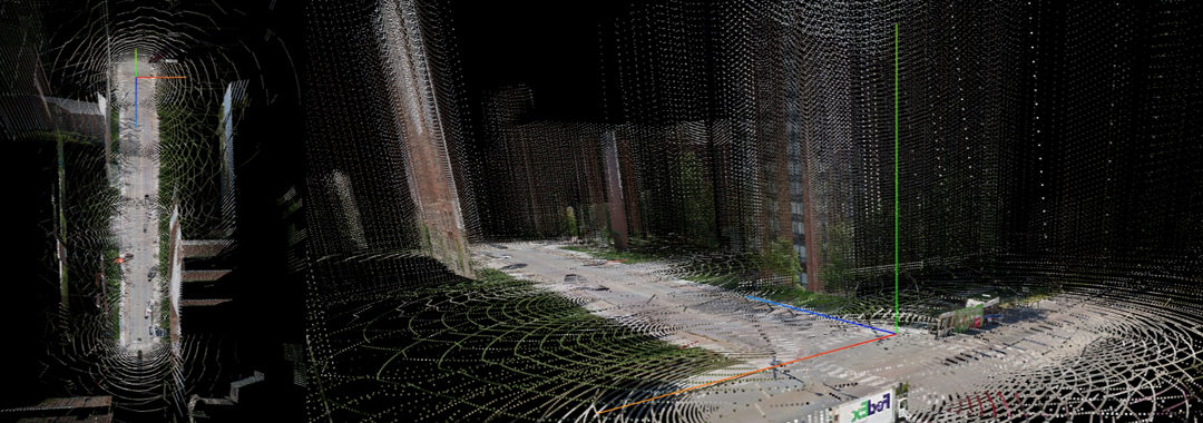
Additionally, the speed with which Google’s laser scanners get reflected by surfaces allows the company to calculate the distance from the camera to objects or buildings, allowing the creation of 3D models to be used in other applications such as Google Earth. Google API indeed provides a way to obtain the depth map corresponding to a specific panorama, information that we will exploit in order to reconstruct the 3D scene. Once decoded and visualized in space, this depth data and the models generated from it may turn out to be useful for many different applications like navigation and augmented reality, but also virtual reality oriented videogames.