
Bringing the Field into the Lab: Large-Scale Visualization of Animal Movement Trajectories within a Virtual Island
October 21st, 2019
Categories: Applications, Software, Visualization, VR
Authors
Aurisano, J., Hwang, J., Johnson, A., Long, L., Crofoot, M., Berger-Wolf, T.About
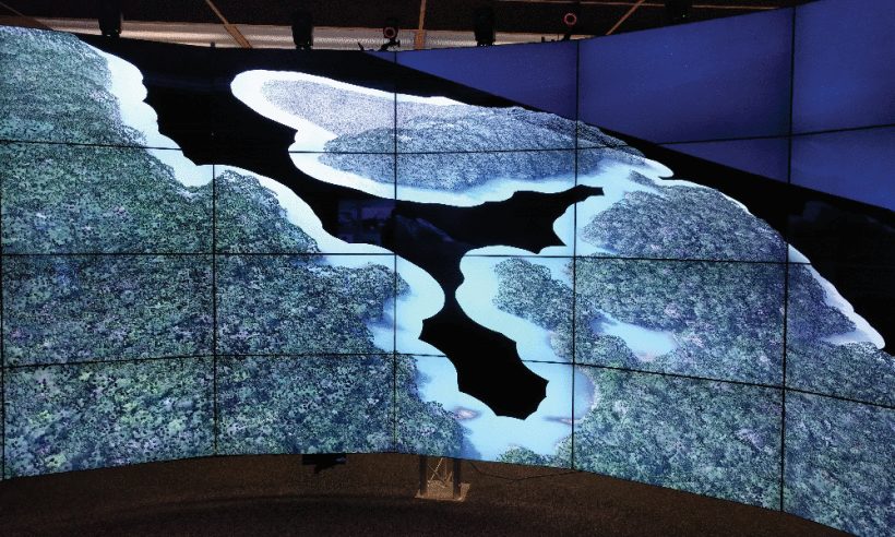
Animal behavior research is becoming an increasingly data-driven field, enabled by advancements in GPS tracking. Rather than directly observe movement and behavior in small numbers of animals, over short time-spans and in small areas, researchers can use GPS collars to track many animals, over large areas and long time spans. These large datasets have the potential to provide rich information about animal behavior. However, this tracking data needs to be integrated with geospatial data about the environment in order to put the movements and estimated behaviors into context. We present an immersive visualization which integrates high resolution topological data from Barro Colorado Island, a 4000 acre island located in the Panama Canal, with GPS tracking data from close to two dozen primates captured over several months. Our application leverages parallelization for rapid filtering of the movement data, allowing researchers to explore the data in a large-scale, immersive environment (CAVE2). We present this work in order to explore the possibility of creating virtual field environments from data, to bring the field into the lab and enable big data animal behavior research.
Index Terms: Human-centered computing, Visualization, Visualization application domains, Scientific visualization
DOI: 10.1109/LDAV48142.2019.8944350
Support provided by National Science Foundation award CNS-1456638.
Resources
URL
Citation
Aurisano, J., Hwang, J., Johnson, A., Long, L., Crofoot, M., Berger-Wolf, T., Bringing the Field into the Lab: Large-Scale Visualization of Animal Movement Trajectories within a Virtual Island, 2019 IEEE 9th Symposium on Large Data Analysis and Visualization (LDAV), Vancouver, BC, Canada, October 21st, 2019. https://ieeexplore.ieee.org/document/8944350