
EVL Faculty Member Fabio Miranda’s TILE2NET Collaborative Research Featured in MIT News
February 22nd, 2023
Categories: Applications, Software, User Groups, Visualization, Visual Analytics, Machine Learning, Data Science
About
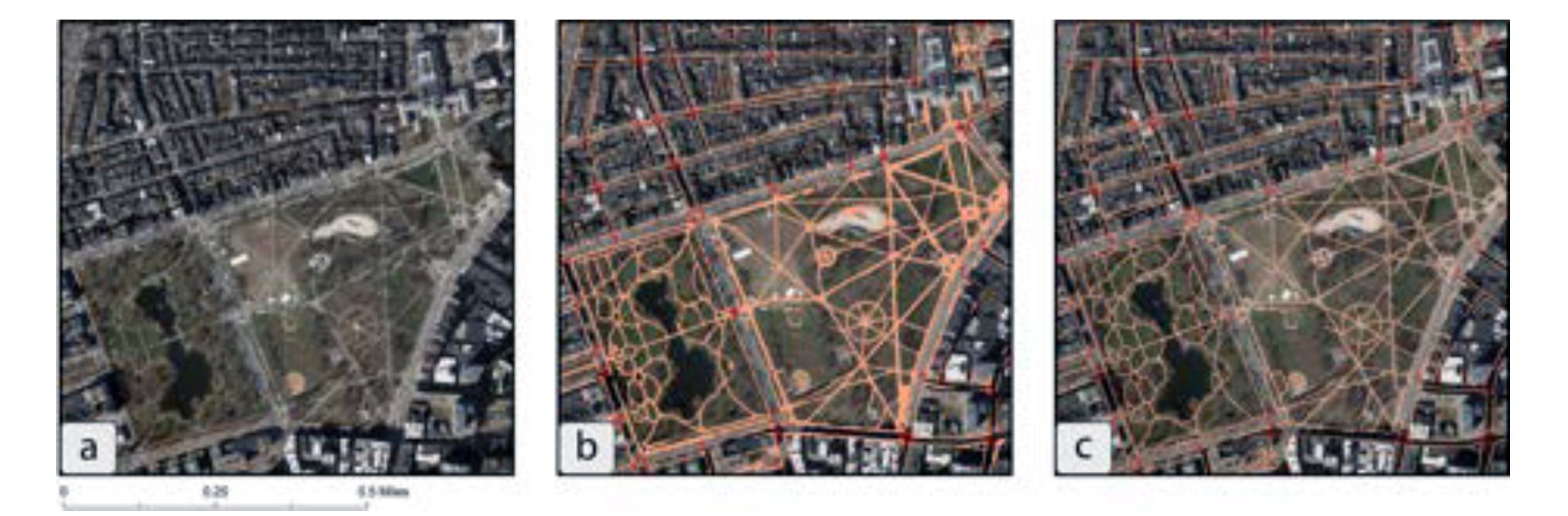
“Where the sidewalk ends” in MIT News discusses how Miranda along with researchers from MIT, University of Sao Paulo, and New York University have built an open-source tool that uses aerial imagery and image-recognition to create complete maps of sidewalks and crosswalks. The tool, called TILE2NET can help planners, policymakers, and urbanists who want to expand pedestrian infrastructure.
The research team used computerized image-recognition techniques to build a tool that will visually recognize sidewalks, crosswalks, and footpaths. To do that, the researchers first used 20,000 aerial images from Boston, Cambridge, New York City, and Washington - places where comprehensive pedestrian maps already existed. By training the image-recognition model on such clearly defined objects and using portions of those cities as a starting point, they were able to see how well TILE2NET would work elsewhere in those cities.
Read the full MIT News article.
For additional information regarding this research see the Computers, Environment and Urban Systems publication “Mapping the walk: A scalable computer vision approach for generating sidewalk network datasets from aerial imagery”.