


Lake Bonney Expedition 2008
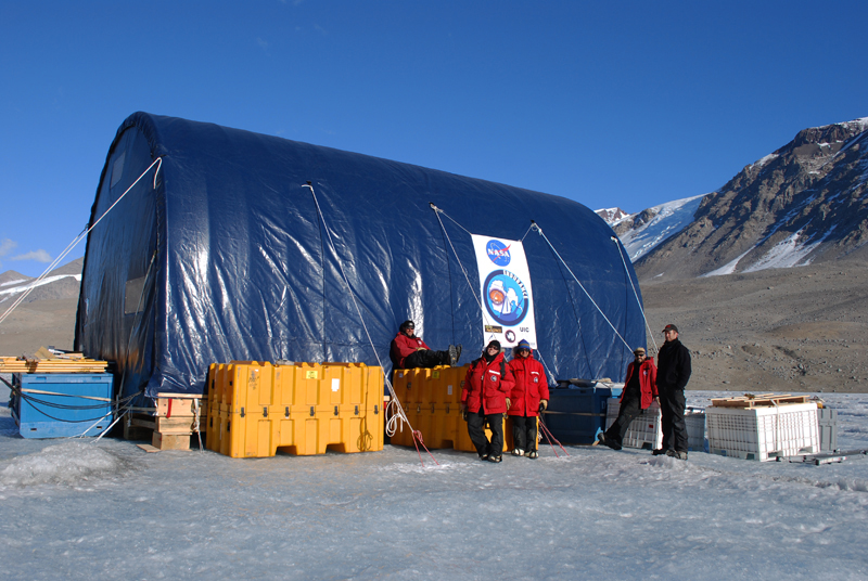
The first deployment has been completed.
Blog entries from Vickie Siegel can
be found below. Latest update:
December 24, 2008.
You can learn more about the 2008 deployment
from Shilpa Gulati, part of the team on the ice, atShilpa's blog and from Robin
Ellwood, an 8th grade science teacher, at this
blog
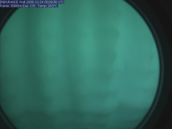
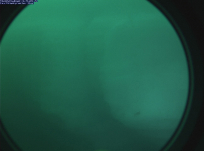
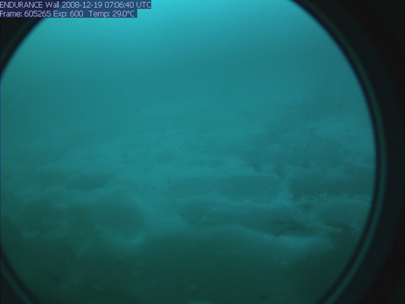
The lake's currently cloudy water made photographing the glacier face practically impossible. Still, it is possible to make out vague shapes and variations in color in these two photos taken by the bot's horizontal-facing camera today.
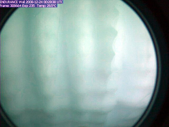
Here is the first image from above, digitally processed to show more detail.
A parting shot of our camp a Blood Falls before we start packing up
Wednesday
December 24, 2008
Today we decided that we would use our last day of mission runs to approach the glacier face for one final time this year. While we have been able to map the glacier surface with the DeltaT over the past several days, the murky water has prevented us from taking the photographs we had hoped to mosaic and overlay onto the 3D surface map we have. Still eager to get some good images despite the poor visibility, Kristof suggested sending the bot to within a few meters of the glacier, closer than our previous stand-off distance. Maybe closer to the face we would be able to get some good images, we hoped. To minimize the risk of any bumping or snagging hazards we decided to visit a flat, uncomplicated stretch of the face that we had spotted in the sonar data from the past few missions.
Since the navigation systems lost lock the last time we approached the glacier close-up, we were cautious in our approach this time. The bot continued to function properly during the entire mission but unfortunately the poor visibility in the water thwarted our attempts to take photos, even at our closer range. The bot returned home and we pulled it out of the icy drink for the last time this year. With our last mission now completed, all that remains for us is to pack up our equipment, break down the bot house and return home to finish processing all of the data that we've collected. Goodbye Lake Bonney - we'll see you again next year!
Santas jolly elves gather around the moon pool to sing us a carol
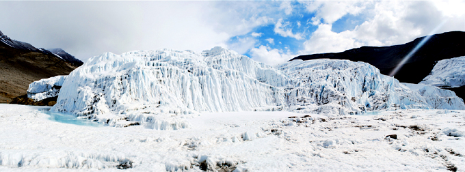
This image is a panorama south to north across the 1 km wide glacier face. We got more than 100 million sonar hits to build the map; only about 5 million are shown here to keep the file size reasonable. In the center portion it appears that the glacier is actually floating on the lake (there is an undercut cave at the bottom that runs about 1/3 the length of the image). You can also see moraine deposits at either end. This is a 2D end-on rendering of the glacier - the data are full 3D and we will be generating some "fly through" videos with the UIC electronic visualization lab over the next month that will give life to this and to the lake chemistry data.
here is a larger version of the image
Tuesday
December 23, 2008
In this morning's group meeting we discussed the possibilities for today's mission. We determined that if we gave the bot a fairly ambitious mission plan today we might be able to get the rest of our DeltaT glacier scans done by the end of the day. We decided to go for it.
Soon after starting to go through the bot's pre-launch checklist we heard someone hail us on the helo communications channel of our radio, accompanied by the distant beat of a helo rotor coming up the valley. We had been informed that there might be visitors today, so we figured we would be giving the grand tour to some folks from McMurdo or Scott Base (New Zealand's science station on Antarctica). The helo landed outside the bot tent and the visitors came in. To our surprise, however, these were not the normal kind of visitors we had seen before. These folks were decked out in red and green, jingle bells, and Santa hats. After marching into the Bot House and singing us a Christmas carol or two they presented us with gifts. The boxes contained the best thing you could bring to a bunch of researchers working on a frozen lake for over a month: food. There were fresh baked cookies, bread, and candies and, one of the most valuable and rare things in you can wish for here in Antarctica, fresh fruit.
Our jolly visitors departed, off to spread cheer to the other field camps, and we munched some cookies and got back to work. We completed the checklist and sent the bot on its way. There were no snags today and the bot succeeded in doing a continuous sonar sweep of the remaining glacier face. Chris took the bot's trip home as a chance to experiment with running the vehicle at higher speeds to find the most power-efficient speed. We took the bot up to a whopping .25 meters per second!
This panorama shows the complex surface of the Taylor Glacier face on the surface. In a few days we'll learn what it looks like underwater, too.
Monday
December 22, 2008
Today we continued our glacier exploration, this time doing a combination sonde drop and glacier-mapping run in the southernmost area of the glacier face. The mission plan took us first to the delta south of the glacier face where we did a few bonus sonde drops in the shallow waters there. Mission control had to do a little bit of maneuvering to avoid some underwater moraines.
From the southern delta, the bot traveled north along the glacier, scanning it with the DeltaT sonar. Things went smoothly until Leah reported that the fiber was feeding out, not in, meaning that the bot was snagged. We managed to unsnag by diving the bot down and then moving to the side to get out of the snag zone before continuing. As the bot proceeded to head home after that it snagged again and this time the diving trick didn't work. Instead, mission control directed the bot to back up past where, calculated from the distance markings on the fiber, they estimated the snag to be. After backing up, we tried diving again and managed to free the bot. Even with the extra time and battery power this delay consumed, the bot returned home after the six and a half hour mission. Now we have some great 3D data from the southern edge of the glacier face. Our job over the next few days will be to continue scanning the north end of the face.
As the weather get warmer, the lake ice gets rougher and rougher. This makes tracking a slower process
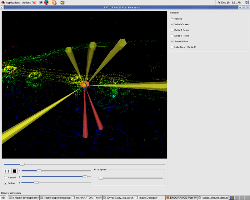
A screenshot of the visualizer program that shows us where the sonars are getting hits
Sunday
December 21, 2008
Recovered and ready to try another approach to the glacier face we sent
the bot to the middle section of the glacier face, just south of our
run on Friday. This would take the bot into the iceberg zone so
the plan was to stop the vehicle periodically and do a sonar sweep to
look for the subsurface portion of the icebergs. If we could, we
would drive the bot into the channel between the glacier face and the
icebergs.
To our surprise, the sonar scans showed nothing under the ice in the
area where icebergs stood 2 meters high on the surface. It would
seem that either the warm water entering the lake near the glacier has
melted the subsurface portion of the bergs or that the surface bergs
were formed ice that spalled off the glacier face never broke the
surface of the lake ice in the first place. In any case, we were
happy that this hypothesized snag hazard didn't exist.
The water continues to be murky so we were unable to take any visual
images of the glacier but we racked up a ton of sonar data on the
glacier face. With today's data and the data from our first
glacier mission combined, we have mapped half of the glacier face so
far.
Saturday
December 20, 2008
Today we took a day off.
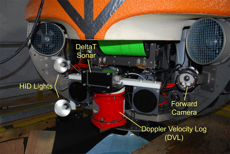
The HID lights, forward camera, and DeltaT sonar were all placed on the front of the vehicle for the glacier mapping missions
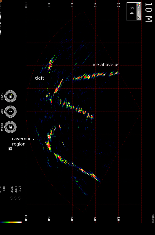
This is a screenshot of the live feedback from the DeltaT sonar. It shows a profile view of the glacier face at this point. The top horizontal stretch is the ice at the lake surface, below that, the glacier wall starts as a curve on the left, the middle point is a ledge jutting out and below that the wall recedes again. Mission control found this pattern common
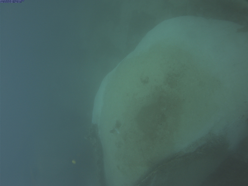
The forward camera took this image of the ice ledge the bot bumped into near the glacier
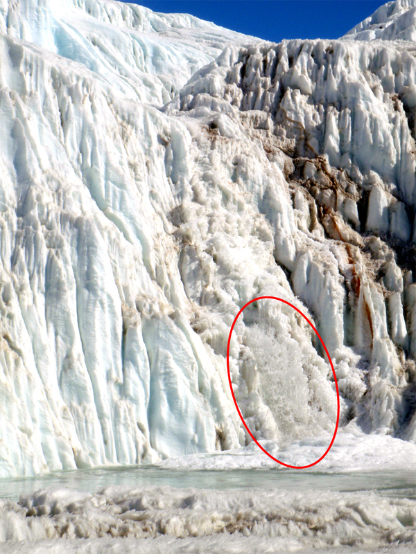
Water has started gushing out of a 3 meter wide hole in the glacier face. The waterfall is about 10 meters high
The visibility in the water has suddenly dropped from almost unlimited to almost 30 cm
Friday
December 19, 2008
Today we shifted gears from running sonde drops at grid points to
mapping the face of the Taylor Glacier. The glacier ends at the
head of West Lobe Bonney and the face of it extends down below the
surface of the lake. Peter is interested in getting a 3D sonar
map and, if possible, photos of the underwater glacier face.
We spent the morning re-arranging some of the sensors on the
vehicle. During the profiler missions we had our multibeam
“DeltaT” sonar facing downwards to map the lake floor as we went from
point to point. For the glacier missions, we want the DeltaT to
face the vertical glacier wall, so we mounted it sideways on the front
of the vehicle. We also moved the horizontal camera and HID
lights to face the same direction as the DeltaT, also on the front of
the bot; previously they faced out from the aft direction of the
vehicle to help us avoid obstacles as we drove the sonde from point to
point.
We were worried that we would snag the fiber close to the glacier
because the lake ice is somewhat broken up there and there are large
icebergs sticking up out of the lake ice. Trying to avoid this,
we drafted a mission plan where we would drive up to the glacier face,
spin the vehicle slowly to get a sonar scan and then retreat along the
same line we approached on. Then we would move sideways 25
meters, approach, scan, and retreat again. The
resulting mission plan looked like a dinner fork, where each tine was
an approach and retreat. It was not an efficient use of battery
power but we hoped it would keep the bot from looping the fiber optic
line around any obstacles out there. The northernmost section of
the glacier face looked the most straightforward and hazard - free so
we
decided to start there.
We started to run the mission and as the bot approached the glacier, it
became evident that somehow either the data on the mission plan map or
in the bot’s navigation was incorrect. The coordinates that
should have had the bot right against the glacier actually left the bot
about 20 meters short of it. Bill and Vickie, who had been
tracking the bot, hopped on the ATV to drive back to the Bot House and
draft some extended coordinates. However, in the last few days,
thanks to the warm weather we’ve been enjoying, the surface of the lake
ice has morphed dramatically and the ATV got stuck in a water-filled
ditch on the rough ice, leaving them soaked and walking back to the Bot
House. Armed with an ice screw and some cargo straps, Maciej went
out to retrieve the ATV as Vickie drafted new coordinates and Bill
changed into dry clothes.
With the new coordinates the bot approached the glacier as originally
intended and the sonar scans reported good data. Bill and Vickie
continued to track the vehicle until Vickie suddenly broke through a
layer of ice, getting wet to her knees, at which point they decided the
ice near the glacier was too instable to follow the bot any further out.
The folks at mission control were getting enticing images from the
horizontal camera so they decided to approach the face a little closer
to get more footage. When they did so, the bot unexpected bumped
into an ice ledge, which knocked out the readings from the DVL (Doppler
Velocity Log). The DVL is a key sensor in the bot’s navigation
system so if it loses lock momentarily the bot becomes entirely
disoriented, even after it regains lock. So now, with the bot in
a place where we could not track it, the bot didn’t know where it
was. Luckily, Chris was able to watch the sonar feedback and
camera images and manually drive the bot away from the wall. The
programmers estimated how much the bot might have drifted before the
DVL regained lock and sent the bot an estimated location and told it to
navigate back to the last point flagged by the tracking team. As
it approached this flag, Bill and Vickie tracked the bot and reported
the error, a few meters, in the bot’s calculation of where the flag
was. Mission control reset the location using this groundtruth
data and sent the bot home.
To make matters even more interesting, by now the batteries were
getting low and the bot was still several hundred meters from the melt
hole. In addition, the visibility in the water had been
decreasing all day and by this point in the mission, the water was
quite murky. The warmer weather has been melting the glacier ice
and there is now a waterfall blasting out a tremendous amount of water
from the glacier face into the lake. Also, the flow in the Santa
Fe stream next to our camp has increased. This influx of water is
stirring the lake up and carrying in very fine grained sediments.
The result is that the crystal clear water we saw this morning is now a
milky stew. The loss of visibility means that the visual homing
program, where the bot follows a blinking light up the melt hole does
not work because it is not be able to see the light.
Exhausted from the stressful mission, we resorted to our recovery
strategy of tugging the bot in by its tether. We navigated to
within a few meters of the melt hole and then Kristof slowly and
carefully pulled the fiber optic line. To everyone’s relief, we
soon saw a dark shadow rising up through the murk. In a few
seconds the shadow became an orange blob and then the bot was
home.
Upon closer inspection we were happy to find that the bot suffered no
major damage from its bump into the wall. The DVL bumped the ice
shelf directly but none of the sonar transducers on it were scratched
and the HID light mounted just to the left of the DVL had been bumped
and was aiming upward but it was not even dented.
Despite the chaos today, we had a successful mission. We
navigated to the glacier face for the first time, got a lot of sonar
data and images, and navigated home. A few more data collection
runs from the glacier face and we will have accomplished our objectives
here at Lake Bonney.
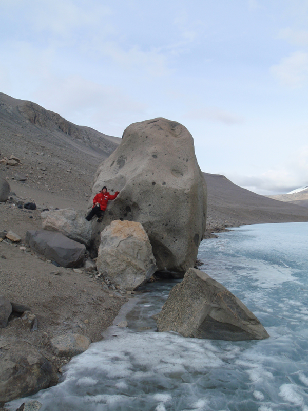
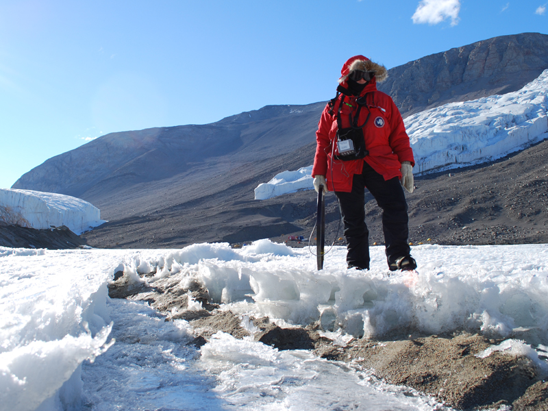
Vickie poses next to Potato Rock on the north shore of West Lobe Lake Bonney. It is rocks like this that had us worried about bringing the bot close to shore in this area of the lake
The sonde camera took this image of a large rock near the north shore, it was about 2 meters tall. We avoided this obstacle and happily didn’t find any others
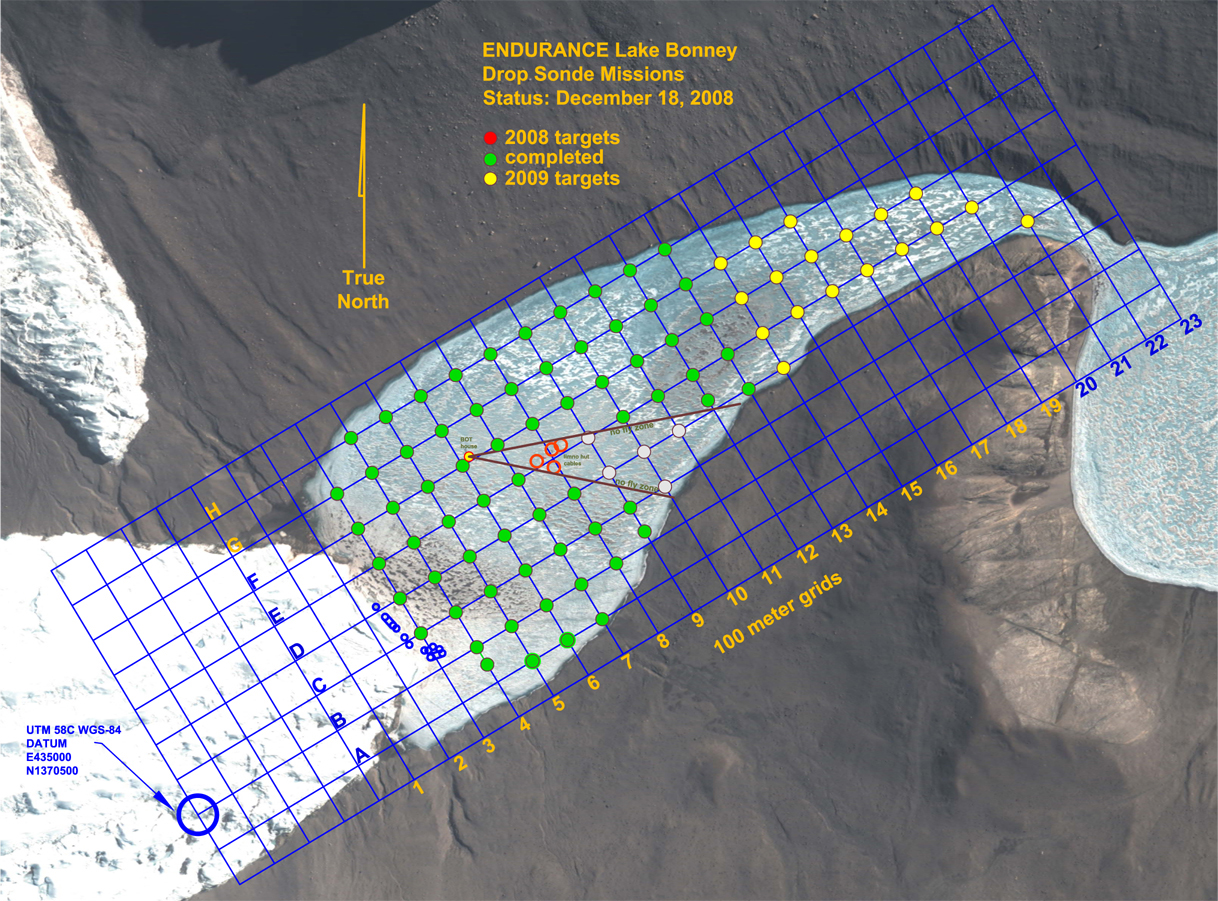
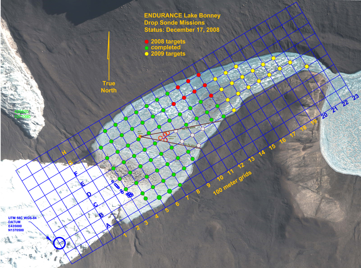
Our status at the end of Mission 7. We have hit all of our sonde targets for this year!
Thursday
December 18, 2008
Mission 7. While yesterday’s mission was pretty long and took us far
from home,
the plan for Mission 7 was even more aggressive today — 1730 meters
long,
and again about 700 meters straightline distance from the Bot
House. Also we would be operating close to shore again. The
north shore of the lake is a steep talus slope that tops out in a large
cliff face about 600 meters vertical distance above the lake.
This slope is littered with huge boulders and it seemed quite likely
that the slope under the ice would have some big rocks, too, hazards
for the bot. So, just like the start of every mission, we had
some reasons to be a little nervous.
We topped the batteries off, dropped the bot in the water and started
off. Vickie and Bill tracked the bot as it traveled between sonde
points. The phono plug on one of the beacon receiver headsets
broke about halfway through the mission and since time is of the
essence with these longer missions, Kristof hopped on the ATV and raced
out to the tracking team to give them a replacement headset so that
there would be no delay in locating the bot.
As the bot approached the north shore in the second half of the
mission, mission control kept a close watch on the water depth and the
obstacle avoidance sonars. As predicted, we encountered a large
rock on the bottom that was big enough to halt our progress to
shore. We did the sonde drop from the safe point we stopped at
and then proceeded parallel to the shore line, approaching more closely
once we passed the rock.
In no time the bot had run through the remaining sonde points without
further incident. On the 350 meter journey back to the Bot House,
we ran the bot on a course parallel to and 30 meters offset from the
path it took out in the morning. This provides us with a patch
test for the multibeam sonar, basically calibration data we can use
when we post-process the sonar data.
The bot made it home safe and sound. With the exception of a
couple of sonde points we might grab later when we are running missions
to the glacier face, we are done with all of our 2008 sonde point
targets; we have succeeded with a large part of our job here this year
and our spirits are high today. Tomorrow we start on another
objective: mapping the glacier face.
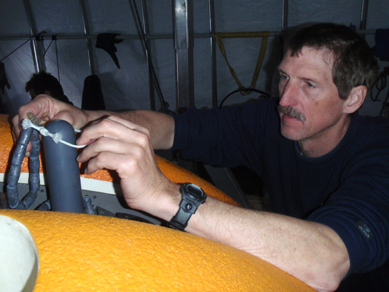
Just before launch, Maciek leans out over the bot to remove as small chunk of syntactic that has broken off and become stuck in the mesh above one of the vertical thrusters
With the batteries back on charge after our aborted launch, Bill works on adjusting the bot’s buoyancy for round two of today’s mission
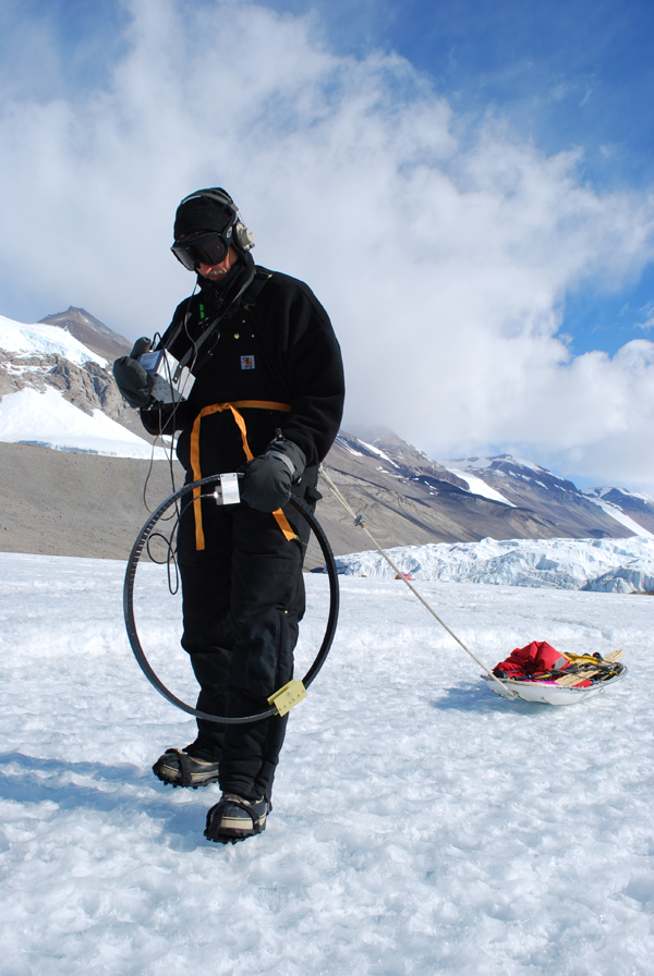
Bill tracks the bot’s radio beacon with a loop antenna while pulling a sled with the flags and kovacs drill needed to mark the sonde drop points
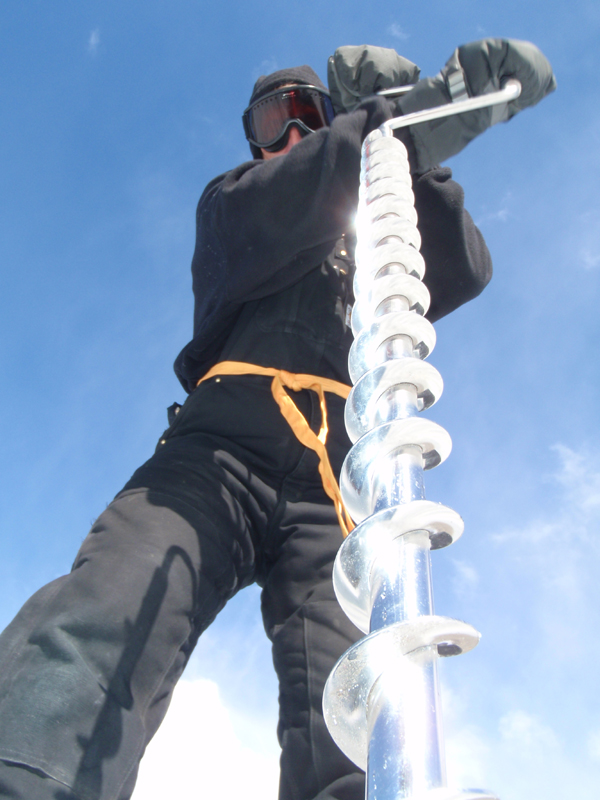
Bill drills a hole in the ice for the bamboo pole that will flag this sonde drop point
Our status at the end of Mission 6. The grid is almost done
Thursday
December 17, 2008
Now that we have our act together on these profiler missions, it is
time to do the riskier missions. In our previous missions we have
picked off almost all of the nearby, easy grid points and now we have
to go further out. The mission plan for today was a 1620 meter
long loop, with 11 grid points. It’s the farthest distance we’ve
planned to traverse, by over 100 meters. According to Bart’s
mission planning worksheet, it cuts into our reserve battery
power. We decided that if we are very efficient with our launch
procedure, we should have enough battery power to run the mission
safely. The second concern is the sheer straight-line distance
from the Bot House to the furthest point on the plan, 704 meters.
If the fiber gets caught that far out, we don’t have enough fiber to
drive it all the way back still connected. Everything needed to
go right today.
We got off to a good start, getting the bot into the water
quickly. The buoyancy, which mysteriously changes a little bit
from day to day, was adjusted and looked good. Just before diving
the bot down to the bottom of the melt hole, we noticed a small white
object in the vertical thruster mesh. Since we didn’t want this
foreign object to interfere with the thruster, Maciek got into a
harness and leaned out over the bot to pick the object out of the mesh,
it was a small chunk of syntactic that must have broken off. We
took the bot down under the ice, went through the rest of our launch
checklist and the bot started off to the first point for the day.
When it got there, the ice-picking maneuver, where the thrusters turn
off and the bot floats up to rest against the ice ceiling, didn’t
work. With the thrusters off the bot was slowly sinking instead
of rising. Somehow, the buoyancy was off. Given our tight
battery budget for the mission we could not afford to keep the
thrusters on to hold the bot against the ceiling, nor could we dally,
find some other solution and then continue on the mission. The
only choice was to go straight back home, take some lead off the bot
and then recharge the batteries to full capacity and start the mission
over.
The bot’s buoyancy in Lake Bonney has consistently been a bit of a
pain. One would think that if we could get the buoyancy just
right one day then, with no changes to the ballast or the bot, the
buoyancy should be the same the next day, but that has not been the
case. There are probably several factors in play here, the bot’s
temperature when it goes in the water, the water temperature and
density in different parts of the lake, microbubbles and so on.
For this reason, we’ve been in the habit of checking the ice-picking
maneuver right at the beginning of every mission, just beyond the melt
hole. Today the ice-picking worked during the launch check but
wasn’t working at the grid point. We couldn’t establish a cause
for this problem so we decided to just deal with the situation by
removing two pounds of lead.
After we had charged the batteries for a few hours we were back to full
charge and ready for Take Two of our mission. This time we were
able to launch the vehicle in even less time and in a flash we were
cruising back out to the first grid point on our mission plan.
This time the bot ice-picked normally, we did the sonde drop and were
off to the next point. By this time in our field season here, all
of our repetitive tasks have become second nature. Chris, Shilpa
and Kristof are able to do sonde drops more efficiently now and Bill
and Vickie have no trouble keeping up while tracking the bot and
flagging the sonde drop points.
On the return leg of the loop there was a moment of concern when the
fiber appeared to be caught but a short dive with the bot cleared up
this problem. When the bot returned to the Bot House, we still
had several amp hours of battery life left, more than we
expected. What’s more, today the bot went as far away from the
melt hole as it will go in Lake Bonney and it returned home
successfully.
Blog entries from previous weeks
can be found below:
Week 1 - Nov 26, 2008 - December 2, 2008
Week 2 - Dec 3, 2008 - December 9, 2008
Week 3 - Dec 10, 2008 - December 16,
2008
Personnel:
Dr. Peter Doran is the
Principal Investigator for the Endurance
project. He has been studying the lakes in the Antarctic Dry Valleys
for 15 years and is a professor at the University of Illinois, Chicago.
Dr. Bill Stone is a
Co-Investigator for Endurance. He is also the
president and CEO of Stone Aerospace, the engineering company that
designed and built the Endurance vehicle.
Dr. John Priscu is a
Co-Investigator from the University of Montana. He
has been studying the lakes in the Antarctic Dry Valleys for over 20
years.
Bart Hogan is a mechanical
engineer for Stone Aerospace.
Dr. Kristof Richmond is a
programmer for Stone Aerospace, focusing on
navigation.
Shilpa Gulati is a programmer
for Stone Aerospace, focusing on the
system executive and machine vision. She is also a PhD student at
University of Texas, Austin.
Chris Flesher is the vehicle
manager, programmer, and electronics
technician for Stone Aerospace. He is a Masters student at UT Austin.
Bob Kenworthy is an electronics
technician for Stone Aerospace.
Vickie Siegel is chief vehicle
technician and logistics manager for Stone Aerospace.
Maciek Obryk is a graduate
student at the University of Illinois at Chicago.
Annika Taylor is a Masters
student at at the University of Illinois at Chicago.