Past Projects
SENSEI: 2014 - 2019
This project is deveoping an ultra-high resolution spherial photometric, radiometric and photogrammetric real-time data-acquisition, sensor-based, camera system.
SIMPLE: 2013 - 2018
This project is the successor to the ENDURANCE project, which is exploring the ecosystems beneath and within the Antarctic ice shelves as a precursor to the search for life on icy worlds such as Europa.
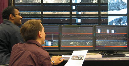
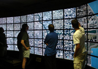
Cyber Commons: 2008 - 2018
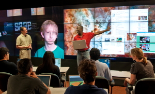
A Cyber-Commons is a technology-enhanced meeting room on a university campus that supports local and distance collaboration and promotes group-oriented problem solving. It is a next-generation computer science resource that relies upon advanced networking and multiple high-definition (HD) displays to transform the traditional computer lab/classroom filled with terminals into a work environment that facilitates and encourages group collaboration.
HANDS: 2009 - 2015
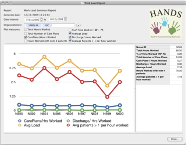
This project is a collaboration between the College of Nursing and the College of Engineering at UIC to improve the HANDS framework for hand-offs between nurses.
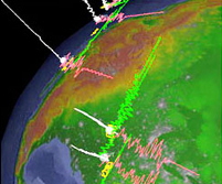
Research, Analysis, and Databasing of Emerging High Power Directed Energy Technologies: 2009 - 2015
This project applies a multidisciplinary approach to the assessment of medical devices and laboratory equipment that utilize directed energy.
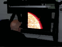
Adler Planetarium's Space Visualization Lab: 2006 - 2014
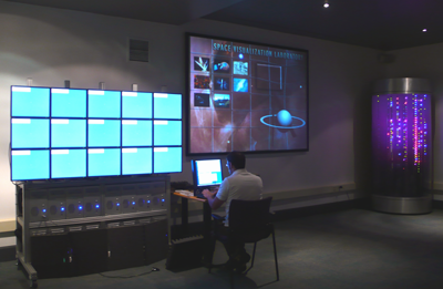
EVL has been working with the Adler Planetarium for several years to deploy EVL's advanced visualization display technologies and applications into a museum setting. This includes a projection-based 3D display system providing viewing of stereo photographs from the surface of Mars, and a tiled LCD display showing high resolution imagery from the Hubble Space Telescope.
OmegaDesk: 2008 - 2012
This project prototypes the work desk of the future combining stereoscopic visuals, touch, and gestural interaction.
LifeLike: 2007 - 2012
LifeLike investigates, develops and evaluates lifelike, natural computer interfaces that support realistic spoken dialog and non-verbal cues.
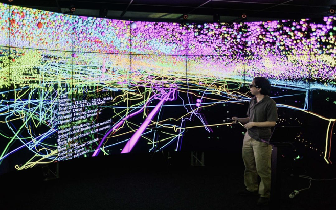
ENDURANCE: 2007 - 2011
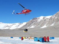
ENDURANCE is an autonomous under water vehicle capable of generating for the first time, 3-dimensional bio and geochemical datasets in the extreme environment of a perennially ice-covered Antarctic dry valley lake. At EVL we are providing visualization support to help plan and execute the missions, as well as interactively visualize the resulting data.
Rising Tides: 2009 - 2011
Thus project, in collaboration with the Science Museum of Minnesota, uses EVL's TacTile multitouch display, to allow visitors to collaboratively explore the effect of sea-level rise on Baltimore.
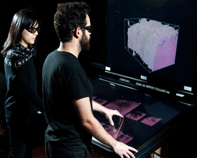
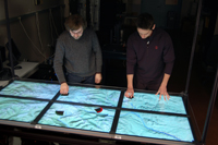
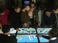
TacTile: 2008 - 2011
TacTile is a 1080p resolution multi-touch LCD display table designed for the visual exporation of scientific datasets. With its HD resolution, it is suitable for both scientific applications as well as museum and informal education applications. By allowing up to 100 simultaneous touches this table format display encourages group interaction.
Disaster Preparedness Training: 2009 - 2010
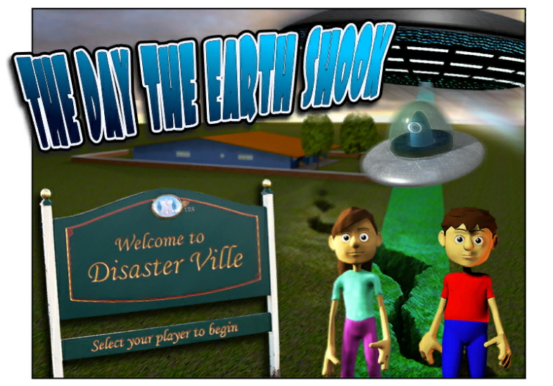
This project, in collaboration with the University of Illinois at Urbana Champaign and funded by the State of Illinois, involves creating an online videogame to teach middle-school children about earthquake preparedness. The game is available to play here
CoreWall: 2004 - 2009
The CoreWall Suite is a real-time stratigraphic correlation, core description and data visualization system used by the marine, terrestrial and Antarctic science communities. It has been deployed twice in Antarctica as part of ANDRILL, and is currently installed on the JOIDES Resolution drill ship.
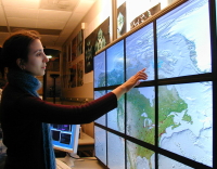
LambdaVision: 2004 - 2009
LambdaVision is an ultra-high-resolution visualization and networking instrument designed to support collaboration among co-located and remote experts requiring interactive ultra-high-resolution imagery. It is made up of 55 LCD tiles and was the first 100 megapixel display built.
Rain Table: 2006 - 2009
Rain Table is an interactive museum exhibit developed by EVL, the University of Minnesota, and the Science Museum of Minnesota. It allows museum visitors to generate rainfall on top of maps on a large high-resolution digital table and then watch as the rain flows down mountains and across fields, cuts channels through slopes and plains, and floods streams and rivers. Rain Table was shown in the Field Museum as part of the travelling water exhibit.
LambdaTable: 2004 - 2009
The LambdaTable is a high-resolution (24 megapixel) tiled LCD tabletop display connected to high-bandwidth optical networks that supports interactive group-based visualization of ultra high-resolution data. A LambdaTable is currently running our Rain Table software at the Field Museum in Chicago as part of the Water exhibit, and will be travelling the country as part of that exhibit.
GeoWall 2: 2002 - 2009
Following on from the success of the GeoWall in viewing 3D imagery, the GeoWall 2 was designed to give Geoscientists display to view very high resolution 2D imagery by using a tiled array of LCD monitors to give almost 30 megapixels of resolution. This project was a stepping stone to the building of EVL's 100 megapixel LambdaVision display. One of EVL's GeoWall 2s was used in January 2009 to help plan security for the Obama innauguration.
Visualization of 3D Forces - 2007
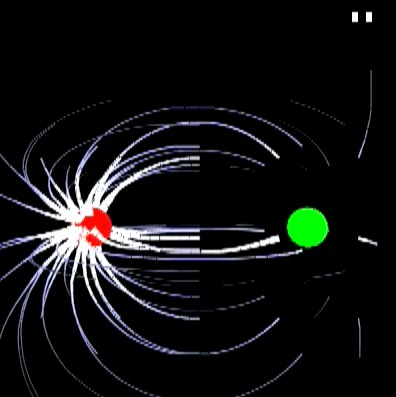
In collaboration with the departments of Mechanical Engineering, Physics, and the Learning Sciences Research Institute at UIC, this work focuses on using visualization to improve undergraduate learning of body forces. These forces are typically illustrated in 2D textbook drawings; being able to view and interact with 3D diagrams of these forces may enhance learning.
GeoWall: 2001 - 2006
A combination of new projection technology, fast graphics cards, and inexpensive computers have made it possible to provide a stereo projection system that is much more affordable than previous commercial solutions. The GeoWall project makes use of these projection systems to visualize structure and dynamics of the Earth in stereo to aid the understanding of spatial relationships. With over 500 deployed, in the mid 90s 1/3 of all non-major undergraduate Earth Science students in the US used a GeoWall as part of their studies.
ImmersaDesk 4: 2005 - 2007
The ImmersaDesk 4 is a desktop-based high resolution passive stereo display which gives 4-megapixels of resolution per eye with optional head tracking. It was used by solar physicists at the Naval Research Laboratory to view stereoscopic movies of the sun as part of NASA's STEREO project.
Cranial Implant Design: 2001 - 2006
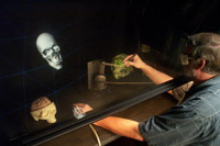
EVL worked with UIC's Virtual Reality in Medicine Laboratory and Department of Neurosurgery to develop a collaborative augmented reality environment with haptic feedback using our PARIS device to provide a precise method to construct and revise pre-surgical cranial implant designs.
Walkabout: 2002 - 2004

Walkabout was software written for the GeoWall Consortium that allows a user to load in geo-referenced terrains to walk on from a first-person perspective, and then interactively drape various textures over those landscapes.
CAVERN: 1998 - 2004
Originally formed to develop solutions for the CAVE Research Network, the CAVERN group at EVL now focuses on developing hardware and software for advanced visualization displays for scientific research, and on developing the next generation networking capability needed to link them together for collaborative work.
Continuum: 2000 - 2003
The Continuum centered around the concept of distributed, collaborative, "amplified work environments" where collaborators gather to solve problems assisted by advanced collaboration, computation and visualization technologies including interactive stereoscopic computer graphics, multi-site audio / video conferencing, and high resolution tiled graphics displays. Backing these technologies are clusters of PCs connected over extremely highspeed gigabit networks.
WiggleView: 2002 - 2003
Wiggleview was a tool developed to help visualize seismic data maintained by IRIS (Incorporated Research Institutions for Seismology) at the Data Management Center (DMC) in Seattle, Washington.
Virtual Harlem: 1999 - 2003
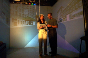
Virtual Harlem was a colaboration between Bryan Carter at Central Missouri State University and EVL to create a virtual representation of Harlem New York in the 1920s-30s in the CAVE to help students better understand the Harlem Renaissance. It was used as a teaching tool in several courses at UIC and was shown on a GeoWall at the Chicago Museum of Science and Industry in 2003.
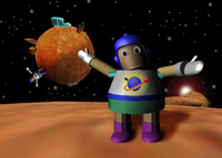
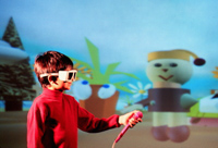
Virtual Ambients: 1999 - 2002
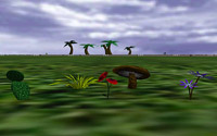
Virtual Ambients are worlds which help us investigate the effectiveness of virtual environments as simulated data collection environments for children engaged in inquiry-based science learning activities. VR can provide access to simulated environments which might otherwise be impossible to visit in person, while still providing experiences analogous to those undertaken by a scientist in real experimental work. Several of these worlds were used by students at Abraham Lincoln Elementary School in Oark Park, IL.
The PARIS: 1998 - 2002
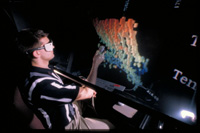
In 1998 EVL began developing the PARIS (Personal Augmented Reality Immersive System) system - a device similar to the ImmersaDesk but using a half-silvered mirror to allow the user's hands to share space with virtual objects, and a co-located haptic device allowing the user to touch the virtual objects.
Round Earth Project: 1997 - 2001
The Round Earth Project investigated how VR could be used to help teach concepts that are counter-intuitive to a learner's currently held mental model; VR can provide an alternative cognitive starting point that does not carry the baggage of past experiences. In particular, we are comparing two strategies for using virtual reality to teach children that the Earth is round when their everyday experience tells them that it is flat. We conducted several studies using the Round Earth environment at Abraham Lincoln Elementary School in Oak Park, IL.
Las Meninas: 1996 - 1997
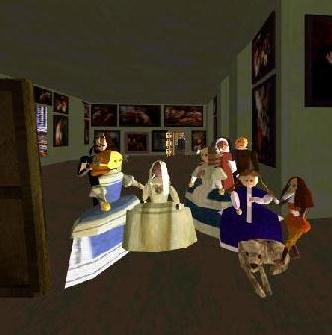
"Las Meninas" the painting raises several questions about the nature of representation, seeing, power, and metaphysics. Our presentation of "Las Meninas" in virtual reality looks at these questions from different perspectives. What happens, for example, when two dimensional representation extends into a three dimensional world, and how does it affect perception? Is the viewer able to solve the enigmas in the painting when he/she is able to explore the hidden space through virtual reality, or are further questions raised?
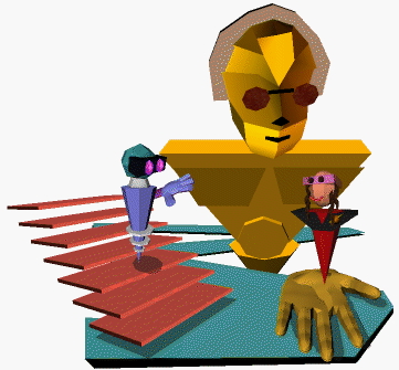
NICE: 1995 - 1999
NICE was a project that applied virtual reality to the creation of a family of educational environments for young users. Our approach was based on constructionism, where real and synthetic users, motivated by an underlying narrative, build persisting virtual worlds through collaboration. NICE was an enhancement of the collaborative infrastructure written for CALVIN which allowed us to have a 17-way VR collaboration across three continents at Supercomputing 97.
CALVIN: 1994 - 1996
CALVIN was an experiment at EVL to create a persistent virtual environment for the CAVE enabling multiple transcontinentally-situated participants to apply collaborative Virtual Reality over high-speed and high-bandwidth networks connected to heterogeneous supercomputing resources and large data stores. This work was demonstrated transcontinentally at Supercomputing '95.
SANDBOX - 1994
The SANDBOX was a virtual reality tool written for the CAVE allowing an investigator to visualize the contents of NASA's FIFE scientific database while retrieving data. As the data in these databases was typically collected through experimentation, an investigator can use the SANDBOX to retrieve data from the database by placing virtual instruments into a virtual reenactment of the original experiment. This work was demonstrated at SIGGRAPH '94.
CASPER - 1992
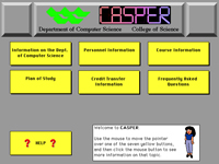
I wrote the CASPER system in the Department of Computer Science at Wayne State University. The goal was to create a central computerised information resource for the students that would contain all of the important information the students would need, and allow the students to cross-reference that information.